
This collection includes tsunami hazard scientific reports and public outreach materials.

-
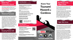
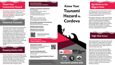
Know Your Tsunami Hazard in Cordova
Beth Grassi, Hannah Chapman-Dutton, Dmitry Nicolsky, and Elena Troshina
Coastal Alaska communities live with the most serious tsunami hazard in the United States. The Alaska Earthquake Center helps coastal communities prepare for the next tsunami disaster. We provide state and local officials with the best available scientific information for addressing the variety of tsunami hazards faced by their communities. These community-specific brochures distill information from several scientific publications, such as tsunami inundation reports, pedestrian travel time maps, and maritime response guidance, into a handy, quick reference. The brochures include maps with community-designated safety information, links for local and statewide tsunami preparedness information, and more. The brochures are rack-card size for easy display, and a great safety resource for both locals and visitors. The Earthquake Center partnered with the Alaska Division of Homeland Security and Emergency Management and the City of Cordova to create this brochure, tailoring the map, safety contact information, and other information to this location.
-
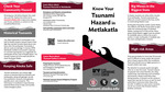
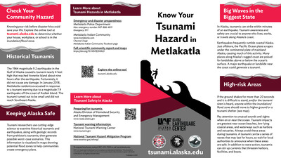
Know Your Tsunami Hazard in Metlakatla
Beth Grassi, Hannah Chapman-Dutton, Dmitry Nicolsky, and Elena Troshina
Coastal Alaska communities live with the most serious tsunami hazard in the United States. The Alaska Earthquake Center helps coastal communities prepare for the next tsunami disaster. We provide state and local officials with the best available scientific information for addressing the variety of tsunami hazards faced by their communities. These community-specific brochures distill information from several scientific publications, such as tsunami inundation reports, pedestrian travel time maps, and maritime response guidance, into a handy, quick reference. The brochures include maps with community-designated safety information, historical tsunami information, as well as links for local and statewide tsunami preparedness information. The brochures are rack-card size for easy display, and a great safety resource for both locals and visitors. The Earthquake Center partnered with the Alaska Division of Homeland Security and Emergency Management and the Metlakatla Indian Community to create this brochure, tailoring the map, safety contact information, and historical information to this location.
-
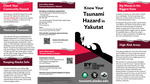
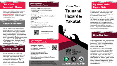
Know Your Tsunami Hazard in Yakutat
Beth Grassi, Hannah Chapman-Dutton, Dmitry Nicolsky, and Elena Troshina
Coastal Alaska communities live with the most serious tsunami hazard in the United States. The Alaska Earthquake Center helps coastal communities prepare for the next tsunami disaster. We provide state and local officials with the best available scientific information for addressing the variety of tsunami hazards faced by their communities. These community-specific brochures distill information from several scientific publications, such as tsunami inundation reports, pedestrian travel time maps, and maritime response guidance, into a handy, quick reference. The brochures include maps with community-designated safety information, historical tsunami information, as well as links for local and statewide tsunami preparedness information. The brochures are rack-card size for easy display, and a great safety resource for both locals and visitors. The Earthquake Center partnered with the Alaska Division of Homeland Security and Emergency Management and the City and Borough of Yakutat to create this brochure, tailoring the map, safety contact information, and historical information to this location.
-
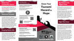
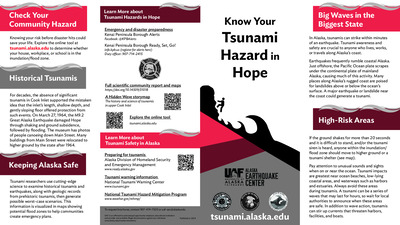
Know Your Tsunami Hazard in Hope
Beth Grassi, Owen Larson, Matt Mockaitis, Dmitry Nicolsky, and Elena Troshina
Coastal Alaska communities live with the most serious tsunami hazard in the United States. The Alaska Earthquake Center helps coastal communities prepare for the next tsunami disaster. We provide state and local officials with the best available scientific information for addressing the variety of tsunami hazards faced by their communities. These community-specific brochures distill information from several scientific publications, such as tsunami inundation reports, pedestrian travel time maps, and maritime response guidance, into a handy, quick reference. The brochures include maps with community-designated safety information, historical tsunami information, as well as links for local and statewide tsunami preparedness information. The brochures are rack-card size for easy display, and a great safety resource for both locals and visitors. The Earthquake Center partnered with the Alaska Division of Homeland Security and Emergency Management and the City of Hope to create this brochure, tailoring the map, safety contact information, and historical information to this location.
-
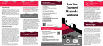
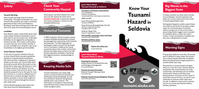
Know Your Tsunami Hazard in Seldovia
Beth Grassi, Owen Larson, Matt Mockaitis, Dmitry Nicolsky, and Elena Troshina
Coastal Alaska communities live with the most serious tsunami hazard in the United States. The Alaska Earthquake Center helps coastal communities prepare for the next tsunami disaster. We provide state and local officials with the best available scientific information for addressing the variety of tsunami hazards faced by their communities. These community-specific brochures distill information from several scientific publications, such as tsunami inundation reports, pedestrian travel time maps, and maritime response guidance, into a handy, quick reference. The brochures include maps with community-designated safety information, historical tsunami information, as well as links for local and statewide tsunami preparedness information. The brochures are rack-card size for easy display, and a great safety resource for both locals and visitors. The Earthquake Center partnered with the Alaska Division of Homeland Security and Emergency Management, the City of Seldovia, and Seldovia Village to create this brochure, tailoring the map, safety contact information, and historical information to this location.
-
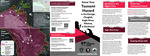
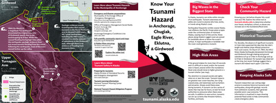
Know Your Tsunami Hazard in Anchorage, Chugiak, Eagle River, Eklutna, and Girdwood
Beth Grassi, Owen Larson, Dmitry Nicolsky, and Elena Troshina
Coastal Alaska communities live with the most serious tsunami hazard in the United States. The Alaska Earthquake Center helps coastal communities prepare for the next tsunami disaster. We provide state and local officials with the best available scientific information for addressing the variety of tsunami hazards faced by their communities. These community-specific brochures distill information from several scientific publications, such as tsunami inundation reports, pedestrian travel time maps, and maritime response guidance, into a handy, quick reference. The brochures include maps with community-designated safety information, historical tsunami information, as well as links for local and statewide tsunami preparedness information. The brochures are rack-card size for easy display, and a great safety resource for both locals and visitors. The Earthquake Center partnered with the Alaska Division of Homeland Security and Emergency Management and the Municipality of Anchorage to create this brochure, tailoring the map, safety contact information, and historical information to this location.
-
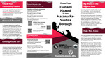
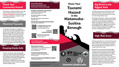
Know Your Tsunami Hazard in the Matanuska-Susitna Borough
Beth Grassi, Owen Larson, Dmitry Nicolsky, and Elena Troshina
Coastal Alaska communities live with the most serious tsunami hazard in the United States. The Alaska Earthquake Center helps coastal communities prepare for the next tsunami disaster. We provide state and local officials with the best available scientific information for addressing the variety of tsunami hazards faced by their communities. These community-specific brochures distill information from several scientific publications, such as tsunami inundation reports, pedestrian travel time maps, and maritime response guidance, into a handy, quick reference. The brochures include maps with community-designated safety information, historical tsunami information, as well as links for local and statewide tsunami preparedness information. The brochures are rack-card size for easy display, and a great safety resource for both locals and visitors. The Earthquake Center partnered with the Alaska Division of Homeland Security and Emergency Management and the Matanuska-Susitna Borough to create this brochure, tailoring the map, safety contact information, and historical information to this location.
-
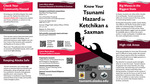
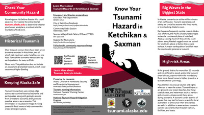
Know Your Tsunami Hazard in Ketchikan and Saxman
Lea Gardine, Beth Grassi, Matt Mockaitis, Dmitry Nicolsky, and Elena Suleimani
Coastal Alaska communities live with the most serious tsunami hazard in the United States. The Alaska Earthquake Center helps coastal communities prepare for the next tsunami disaster. We provide state and local officials with the best available scientific information for addressing the variety of tsunami hazards faced by their communities. These community-specific brochures distill information from several scientific publications, such as tsunami inundation reports, pedestrian travel time maps, and maritime response guidance, into a handy, quick reference. The brochures include maps with community-designated safety information, historical tsunami information, as well as links for local and statewide tsunami preparedness information. The brochures are rack-card size for easy display, and a great safety resource for both locals and visitors. The Earthquake Center partnered with the Alaska Division of Homeland Security and Emergency Management, the City of Ketchikan, and the City of Saxman to create this brochure, tailoring the map, safety contact information, and historical information to this location.
-
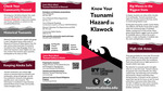
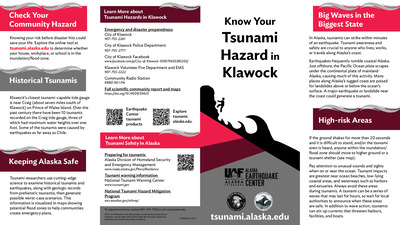
Know Your Tsunami Hazard in Klawock
Lea Gardine, Beth Grassi, Matt Mockaitis, Dmitry Nicolsky, and Elena Suleimani
Coastal Alaska communities live with the most serious tsunami hazard in the United States. The Alaska Earthquake Center helps coastal communities prepare for the next tsunami disaster. We provide state and local officials with the best available scientific information for addressing the variety of tsunami hazards faced by their communities. These community-specific brochures distill information from several scientific publications, such as tsunami inundation reports, pedestrian travel time maps, and maritime response guidance, into a handy, quick reference. The brochures include maps with community-designated safety information, historical tsunami information, as well as links for local and statewide tsunami preparedness information. The brochures are rack-card size for easy display, and a great safety resource for both locals and visitors. The Earthquake Center partnered with the Alaska Division of Homeland Security and Emergency Management and the City of Klawock to create this brochure, tailoring the map, safety contact information, and historical information to this location.
-
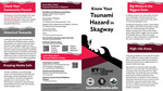
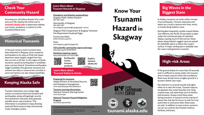
Know Your Tsunami Hazard in Skagway
Lea Gardine, Beth Grassi, Matt Mockaitis, Dmitry Nicolsky, and Elena Suleimani
Coastal Alaska communities live with the most serious tsunami hazard in the United States. The Alaska Earthquake Center helps coastal communities prepare for the next tsunami disaster. We provide state and local officials with the best available scientific information for addressing the variety of tsunami hazards faced by their communities. These community-specific brochures distill information from several scientific publications, such as tsunami inundation reports, pedestrian travel time maps, and maritime response guidance, into a handy, quick reference. The brochures include maps with community-designated safety information, historical tsunami information, as well as links for local and statewide tsunami preparedness information. The brochures are rack-card size for easy display, and a great safety resource for both locals and visitors. The Earthquake Center partnered with the Alaska Division of Homeland Security and Emergency Management and the Municipality of Skagway to create this brochure, tailoring the map, safety contact information, and historical information to this location.
-
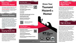
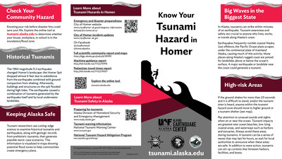
Know Your Tsunami Hazard in Homer
Lea Gardine, Beth Grassi, Dmitry Nicolsky, and Elena Suleimani
Coastal Alaska communities live with the most serious tsunami hazard in the United States. The Alaska Earthquake Center helps coastal communities prepare for the next tsunami disaster. We provide state and local officials with the best available scientific information for addressing the variety of tsunami hazards faced by their communities. These community-specific brochures distill information from several scientific publications, such as tsunami inundation reports, pedestrian travel time maps, and maritime response guidance, into a handy, quick reference. The brochures include maps with community-designated safety information, historical tsunami information, as well as links for local and statewide tsunami preparedness information. The brochures are rack-card size for easy display, and a great safety resource for both locals and visitors. The Earthquake Center partnered with the Alaska Division of Homeland Security and Emergency Management and the City of Homer to create this brochure, tailoring the map, safety contact information, and historical information to this location.
-
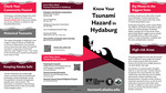
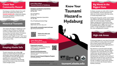
Know Your Tsunami Hazard in Hydaburg
Lea Gardine, Beth Grassi, Dmitry Nicolsky, and Elena Suleimani
Coastal Alaska communities live with the most serious tsunami hazard in the United States. The Alaska Earthquake Center helps coastal communities prepare for the next tsunami disaster. We provide state and local officials with the best available scientific information for addressing the variety of tsunami hazards faced by their communities. These community-specific brochures distill information from several scientific publications, such as tsunami inundation reports, pedestrian travel time maps, and maritime response guidance, into a handy, quick reference. The brochures include maps with community-designated safety information, historical tsunami information, as well as links for local and statewide tsunami preparedness information. The brochures are rack-card size for easy display, and a great safety resource for both locals and visitors. The Earthquake Center partnered with the Alaska Division of Homeland Security and Emergency Management and the City of Hydaburg to create this brochure, tailoring the map, safety contact information, and historical information to this location.
-
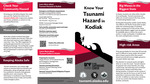
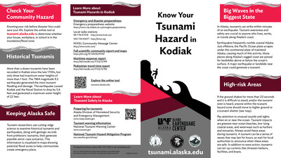
Know Your Tsunami Hazard in Kodiak
Lea Gardine, Beth Grassi, Dmitry Nicolsky, and Elena Suleimani
Coastal Alaska communities live with the most serious tsunami hazard in the United States. The Alaska Earthquake Center helps coastal communities prepare for the next tsunami disaster. We provide state and local officials with the best available scientific information for addressing the variety of tsunami hazards faced by their communities. These community-specific brochures distill information from several scientific publications, such as tsunami inundation reports, pedestrian travel time maps, and maritime response guidance, into a handy, quick reference. The brochures include maps with community-designated safety information, historical tsunami information, as well as links for local and statewide tsunami preparedness information. The brochures are rack-card size for easy display, and a great safety resource for both locals and visitors. The Earthquake Center partnered with the Alaska Division of Homeland Security and Emergency Management and the City of Kodiak to create this brochure, tailoring the map, safety contact information, and historical information to this location.
-
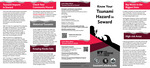
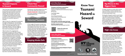
Know Your Tsunami Hazard in Seward
Lea Gardine, Beth Grassi, Dmitry Nicolsky, and Elena Suleimani
Coastal Alaska communities live with the most serious tsunami hazard in the United States. The Alaska Earthquake Center helps coastal communities prepare for the next tsunami disaster. We provide state and local officials with the best available scientific information for addressing the variety of tsunami hazards faced by their communities. These community-specific brochures distill information from several scientific publications, such as tsunami inundation reports, pedestrian travel time maps, and maritime response guidance, into a handy, quick reference. The brochures include maps with community-designated safety information, historical tsunami information, as well as links for local and statewide tsunami preparedness information. The brochures are rack-card size for easy display, and a great safety resource for both locals and visitors. The Earthquake Center partnered with the Alaska Division of Homeland Security and Emergency Management and the City of Seward to create this brochure, tailoring the map, safety contact information, and historical information to this location.
-
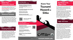
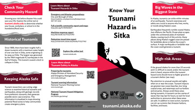
Know Your Tsunami Hazard in Sitka
Lea Gardine, Beth Grassi, Dmitry Nicolsky, and Elena Suleimani
Coastal Alaska communities live with the most serious tsunami hazard in the United States. The Alaska Earthquake Center helps coastal communities prepare for the next tsunami disaster. We provide state and local officials with the best available scientific information for addressing the variety of tsunami hazards faced by their communities. These community-specific brochures distill information from several scientific publications, such as tsunami inundation reports, pedestrian travel time maps, and maritime response guidance, into a handy, quick reference. The brochures include maps with community-designated safety information, historical tsunami information, as well as links for local and statewide tsunami preparedness information. The brochures are rack-card size for easy display, and a great safety resource for both locals and visitors. The Earthquake Center partnered with the Alaska Division of Homeland Security and Emergency Management and the City of Sitka to create this brochure, tailoring the map, safety contact information, and historical information to this location.
-
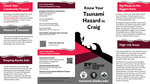
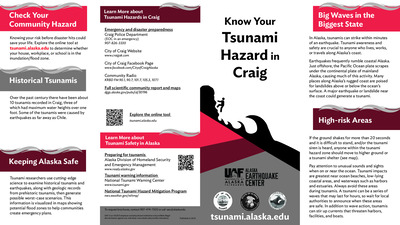
Know Your Tsunami Hazard in Craig
Lea Gardine, Beth Grassi, Elena Suleimani, and Dmitry Nicolsky
Coastal Alaska communities live with the most serious tsunami hazard in the United States. The Alaska Earthquake Center helps coastal communities prepare for the next tsunami disaster. We provide state and local officials with the best available scientific information for addressing the variety of tsunami hazards faced by their communities. These community-specific brochures distill information from several scientific publications, such as tsunami inundation reports, pedestrian travel time maps, and maritime response guidance, into a handy, quick reference. The brochures include maps with community-designated safety information, historical tsunami information, as well as links for local and statewide tsunami preparedness information. The brochures are rack-card size for easy display, and a great safety resource for both locals and visitors. The Earthquake Center partnered with the Alaska Division of Homeland Security and Emergency Management and the City of Craig to create this brochure, tailoring the map, safety contact information, and historical information to this location.
-

Maritime Guidance for Distant and Local Source Tsunami Events: Haines and Skagway, Alaska
Dmitry Nicolsky and Lea Gardine
These documents provide response guidance for Haines and Skagway, Alaska in the event of tsunamis for small vessels such as recreational sailing and motor vessels, and commercial fishing vessels. The developed documents follow the guidance developed by the National Tsunami Hazard Mitigation Program (NTHMP) and are based on anticipated effects of a maximum-considered distant and locally generated tsunami event.
-
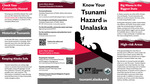
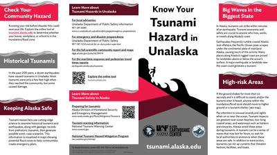
Know Your Tsunami Hazard in Unalaska
Lea Gardine, Beth Grassi, Elena Suleimani, and Dmitry Nicolsky
Coastal Alaska communities live with the most serious tsunami hazard in the United States. The Alaska Earthquake Center helps coastal communities prepare for the next tsunami disaster. We provide state and local officials with the best available scientific information for addressing the variety of tsunami hazards faced by their communities. These community-specific brochures distill information from several scientific publications, such as tsunami inundation reports, pedestrian travel time maps, and maritime response guidance, into a handy, quick reference. The brochures include maps with community-designated safety information, historical tsunami information, as well as links for local and statewide tsunami preparedness information. The brochures are rack-card size for easy display, and a great safety resource for both locals and visitors. The Earthquake Center partnered with the Alaska Division of Homeland Security and Emergency Management and the City of Unalaska to create this brochure, tailoring the map, safety contact information, and historical information to this location.
-
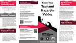
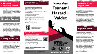
Know Your Tsunami Hazard in Valdez
Lea Gardine, Beth Grassi, Elena Suleimani, and Dmitry Nicolsky
Coastal Alaska communities live with the most serious tsunami hazard in the United States. The Alaska Earthquake Center helps coastal communities prepare for the next tsunami disaster. We provide state and local officials with the best available scientific information for addressing the variety of tsunami hazards faced by their communities. These community-specific brochures distill information from several scientific publications, such as tsunami inundation reports, pedestrian travel time maps, and maritime response guidance, into a handy, quick reference. The brochures include maps with community-designated safety information, historical tsunami information, as well as links for local and statewide tsunami preparedness information. The brochures are rack-card size for easy display, and a great safety resource for both locals and visitors. The Earthquake Center partnered with the Alaska Division of Homeland Security and Emergency Management and the City of Valdez to create this brochure, tailoring the map, safety contact information, and historical information to this location.
-
PEDESTRIAN TRAVEL-TIME MAPS FOR CORDOVA, ALASKA: An anisotropic model to support tsunami evacuation planning
Amy Macpherson, Lea Gardine, and Dmitry Nicolsky
Tsunami-induced pedestrian evacuation for Cordova is evaluated using an anisotropic modeling approach developed by the U.S. Geological Survey. The method is based on path-distance algorithms and accounts for variations in land cover and directionality in the slope of terrain. We model evacuation of pedestrians to exit points from the tsunami hazard zone. The pedestrian travel is restricted to the roads only. Results presented here are intended to provide guidance to local emergency management agencies for tsunami inundation assessment, evacuation planning, and public education to mitigate future tsunami hazards.
-
PEDESTRIAN TRAVEL-TIME MAPS FOR SITKA, ALASKA: An anisotropic model to support tsunami evacuation planning
Amy Macpherson, Lea Gardine, and Dmitry Nicolsky
Tsunami-induced pedestrian evacuation for Sitka is evaluated using an anisotropic modeling approach developed by the U.S. Geological Survey. The method is based on path-distance algorithms and accounts for variations in land cover and directionality in the slope of terrain. We model evacuation of pedestrians to exit points from the tsunami hazard zone. The pedestrian travel is restricted to the roads only. Results presented here are intended to provide guidance to local emergency management agencies for tsunami inundation assessment, evacuation planning, and public education to mitigate future tsunami hazards.
-
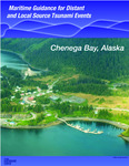
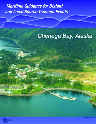
Maritime Guidance for Distant and Local Source Tsunami Events: Chenega Bay, Alaska
Dmitry Nicolsky, Elena Suleimani, and Lea Gardine
These documents provide response guidance for Chenega Bay in the event of tsunamis for small vessels such as recreational sailing and motor vessels, and commercial fishing vessels. The developed documents follow the guidance developed by the National Tsunami Hazard Mitigation Program (NTHMP) and are based on anticipated effects of a maximum-considered distant and locally generated tsunami event.
-
Maritime Guidance for Distant and Local Source Tsunami Events: Cordova Harbor, Alaska
Dmitry Nicolsky, Elena Suleimani, and Lea Gardine
-
Maritime Guidance for Distant and Local Source Tsunami Events: Homer Harbor, Alaska
Dmitry Nicolsky, Elena Suleimani, and Lea Gardine
-
Maritime Guidance for Distant and Local Source Tsunami Events: Seldovia Harbor, Alaska
Dmitry Nicolsky, Elena Suleimani, and Lea Gardine