

This collection includes tsunami hazard scientific reports and public outreach materials.

-

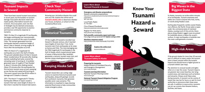
Maritime Guidance for Distant and Local Source Tsunami Events: Seward Harbor, Alaska
Dmitry Nicolsky, Elena Suleimani, and Lea Gardine
-
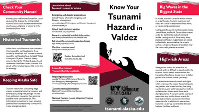
Maritime Guidance for Distant and Local Source Tsunami Events: Valdez Harbor, Alaska
Dmitry Nicolsky, Elena Suleimani, and Lea Gardine
-
Maritime Guidance for Distant and Local Source Tsunami Events: Whittier Harbor, Alaska
Dmitry Nicolsky, Elena Suleimani, and Lea Gardine
-
PEDESTRIAN TRAVEL-TIME MAPS FOR PERRYVILLE, ALASKA: An anisotropic model to support tsunami evacuation planning
Lea Gardine and Dmitry Nicolsky
Tsunami-induced pedestrian evacuation for the community of Perryville is evaluated using an anisotropic modeling approach developed by the U.S. Geological Survey. The method is based on path-distance algorithms and accounts for variations in land cover and directionality in the slope of terrain. We model evacuation of pedestrians to exit points located at the tsunami hazard zone boundary. Pedestrian travel-time maps are computed for two cases: i) travel to an existing evacuating shelter and ii) travel to either the evacuation or an alternative shelter. Results presented here are intended to provide guidance to local emergency management agencies for tsunami inundation assessment, evacuation planning, and public education to mitigate future tsunami hazards.
-
PEDESTRIAN TRAVEL-TIME MAPS FOR WHITTIER, ALASKA: An anisotropic model to support tsunami evacuation planning
Lea Gardine and Dmitry Nicolsky
Tsunami-induced pedestrian evacuation for the community of Whittier is evaluated using an anisotropic modeling approach developed by the U.S. Geological Survey. The method is based on path-distance algorithms and accounts for variations in land cover and directionality in the slope of terrain. We model evacuation of pedestrians to exit points from the tsunami hazard zone boundary. The pedestrian travel is restricted to the roads only. Results presented here are intended to provide guidance to local emergency management agencies for tsunami inundation assessment, evacuation planning, and public education to mitigate future tsunami hazards.
-
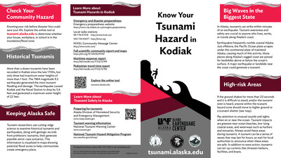
PEDESTRIAN TRAVEL-TIME MAPS FOR KODIAK, ALASKA: An anisotropic model to support tsunami evacuation planning
Dmitry Nicolsky and Lea Gardine
Tsunami-induced pedestrian evacuation for the City of Kodiak, U.S. Coast Guard Base and the community of Womens Bay is evaluated using an anisotropic modeling approach developed by the U.S. Geological Survey. The method is based on path-distance algorithms and accounts for variations in land cover and directionality in the slope of terrain. We model evacuation of pedestrians to exit points from the tsunami hazard zone. The pedestrian travel is restricted to the roads only. Results presented here are intended to provide guidance to local emergency management agencies for tsunami inundation assessment, evacuation planning, and public education to mitigate future tsunami hazards.
-
Maritime Guidance for Distant and Local Source Tsunami Events: Kodiak, Alaska
Dmitry Nicolsky, Elena Suleimani, and Lea Gardine
These documents provide response guidance for Kodiak Harbor in the event of tsunamis for small vessels such as recreational sailing and motor vessels, and commercial fishing vessels. The developed documents follow the guidance developed by the National Tsunami Hazard Mitigation Program (NTHMP) and are based on anticipated effects of a maximum-considered distant and locally generated tsunami event.
-
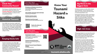
Maritime Guidance for Distant and Local Source Tsunami Events: Sitka, Alaska
Dmitry Nicolsky, Elena Suleimani, and Lea Gardine
-
Maritime Guidance for Distant and Local Source Tsunami Events: Tatitlek, Alaska
Dmitry Nicolsky, Elena Suleimani, and Lea Gardine
These documents provide response guidance for Tatitlek Harbor in the event of tsunamis for small vessels such as recreational sailing and motor vessels, and commercial fishing vessels. The developed documents follow the guidance developed by the National Tsunami Hazard Mitigation Program (NTHMP) and are based on anticipated effects of a maximum-considered distant and locally generated tsunami event.
-
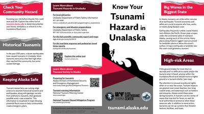
Maritime Guidance for Distant and Local Source Tsunami Events: Unalaska, Alaska
Dmitry Nicolsky, Elena Suleimani, and Lea Gardine
These documents provide response guidance for Unalaska/Dutch Harbor in the event of tsunamis for small vessels such as recreational sailing and motor vessels, and commercial fishing vessels. The developed documents follow the guidance developed by the National Tsunami Hazard Mitigation Program (NTHMP) and are based on anticipated effects of a maximum-considered distant and locally generated tsunami event.
-
Pedestrian Travel-Time Maps for Chignik, Alaska: An anisotropic model to support tsunami evacuation planning
A.E. Macpherson, D.J. Nicolsky, and R.D. Koehler
Tsunami-induced pedestrian evacuation for the community of Chignik is evaluated using an anisotropic modeling approach developed by the U.S. Geological Survey. The method is based on path-distance algorithms and accounts for variations in land cover and directionality in the slope of terrain. We model evacuation of pedestrians to the tsunami hazard zone boundary and to predetermined assembly areas. Pedestrian travel-time maps are computed for two cases: for travel across all viable terrain or by roads only. Results presented here are intended to provide guidance to local emergency management agencies for tsunami inundation assessment, evacuation planning, and public education to mitigate future tsunami hazards. This report was funded by the National Tsunami Hazard Mitigation Program grant to the Alaska Division of Homeland Security and Emergency Management and University of Alaska Fairbanks from the Department of Commerce/National Oceanic at Atmospheric Administration (NOAA). This does not constitute an endorsement by Alaska Earthquake Center (AEC) or NOAA.
-
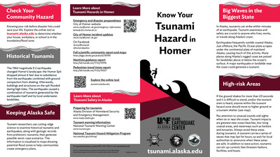
Pedestrian Travel-Time Maps for Homer, Alaska: An anisotropic model to support tsunami evacuation planning
A.E. Macpherson, D.J. Nicolsky, and R.D. Koehler
Tsunami-induced pedestrian evacuation for the community of Homer is evaluated using an anisotropic modeling approach developed by the U.S. Geological Survey. The method is based on path-distance algorithms and accounts for variations in land cover and directionality in the slope of terrain. We model evacuation of pedestrians to the tsunami hazard zone boundary and to predetermined assembly areas. The pedestrian travel-time maps are computed for two cases: for travel across all variable terrain or by roads only. Results presented here are intended to provide guidance to local emergency management agencies in tsunami inundation assessment, evacuation planning, and public education to mitigate future tsunami hazards. This report was funded by the National Tsunami Hazard Mitigation Program grant to the Alaska Division of Homeland Security and Emergency Management and University of Alaska Fairbanks from the Department of Commerce/National Oceanic at Atmospheric Administration (NOAA). This does not constitute an endorsement by Alaska Earthquake Center (AEC) or NOAA.
-
Pedestrian Travel-Time Maps for King Cove, Alaska: An anisotropic model to support tsunami evacuation planning
A.E. Macpherson, D.J. Nicolsky, and R.D. Koehler
Tsunami-induced pedestrian evacuation for the community of King Cove is evaluated using an anisotropic modeling approach developed by the U.S. Geological Survey. The applied method is based on path-distance algorithms and accounts for variations in land cover and directionality in the slope of terrain. We model evacuation of pedestrians to the tsunami hazard zone boundary and to predetermined assembly areas. The pedestrian travel-time maps are computed for two cases: for travel across all viable terrain or by roads only. Results presented here are intended to provide guidance to local emergency management agencies for tsunami inundation assessment, evacuation planning, and public education to mitigate future tsunami hazards. This report was funded by the National Tsunami Hazard Mitigation Program grant to the Alaska Division of Homeland Security and Emergency Management and University of Alaska Fairbanks from the Department of Commerce/National Oceanic at Atmospheric Administration (NOAA). This does not constitute an endorsement by Alaska Earthquake Center (AEC) or NOAA.
-
Pedestrian Travel-Time Maps for Unalaska/Dutch Harbor, Alaska: An anisotropic model to support tsunami evacuation planning
A.E. Macpherson, D.J. Nicolsky, and R.D. Koehler
Tsunami-induced pedestrian evacuation for the community of Unalaska/Dutch Harbor is evaluated using an anisotropic modeling approach developed by the U.S. Geological Survey. The method is based on pathdistance algorithms and accounts for variations in land cover and directionality in the slope of terrain. We model evacuation of pedestrians to the tsunami hazard zone boundary and to predetermined assembly areas. Pedestrian travel-time maps are computed for two cases: for travel across all viable terrain or by roads only. Results presented here are intended to provide guidance to local emergency management agencies for tsunami inundation assessment, evacuation planning, and public education to mitigate future tsunami hazards. This report was funded by the National Tsunami Hazard Mitigation Program grant to the Alaska Division of Homeland Security and Emergency Management and University of Alaska Fairbanks from the Department of Commerce/National Oceanic at Atmospheric Administration (NOAA). This does not constitute an endorsement by Alaska Earthquake Center (AEC) or NOAA.